Aracaju
 |
 |
The extinct unclassified Boime language (also spelled Poyme) was spoken by indigenous peoples near Aracajú on the São Francisco River.
The land of present-day Aracaju was located in a sesmaria given to Pero Gonçalves by the Portuguese crown around 1602. The land consisted of 160 km of coastline with small fishing villages. A village called Santo Antônio de Aracaju was recorded in 1699. It was located at the mouth of the Sergipe River at the Atlantic Ocean, and was founded by João Mulato, an indigenous Brazilian. The settlement saw little growth in the 18th century, and was part of the parish of Nossa Senhora do Perpétuo Socorro do Tomar do Cotinguiba. The capital of São Cristóvão presented numerous difficulties as the capital of Sergipe, primarily its inland location. São Cristóvão had only a small port on a river, and was accessed only with small boats. As a result, large ships were unable to land in Sergipe. Government officials in Sergipe began a search for land for a new capital in the 1850s. The beach that is now located in Aracaju near the mouth of the Sergipe River was a major point of interest. The state government transferred the customs and the Provincial Revenue Bureau to that location. They additionally built a post office and police sub-station. In addition, a port was built on the beach, called Atalaia.
The capital of the state of Sergipe was moved from São Cristóvão to Aracaju on March 17, 1855.
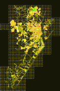
Map - Aracaju
Map
Country - Brazil
Currency / Language
| ISO | Currency | Symbol | Significant figures |
|---|---|---|---|
| BRL | Brazilian real | R$ | 2 |
| ISO | Language |
|---|---|
| EN | English language |
| FR | French language |
| PT | Portuguese language |
| ES | Spanish language |


